Winter forecast cloudy for the U.P.

Noah Johnson Daily Press An Escanaba resident uses a snowblower to clear his driveway after snow hit the area. According to folklore, groundhogs will be able to predict how much winter weather if left this season on Sunday — Groundhog Day.

ESCANABA — Sunday is Groundhog Day, and folklore has it if the groundhog sees its shadow, winter will continue. If he doesn’t, an early spring is headed our way. Experts weighed in, saying it’s unclear whether the groundhog will see its shadow, but they have their own predictions.
The National Weather Service (NWS) in Negaunee recently released a climate outlook highlighting the expected weather for the next three months into spring across the United States.
According to the report, the Upper Peninsula has an equal chance of being below or above the normal temperature in February, March, and April.
NWS Science and Operations Officer Dan Thompson weighed in, explaining what the outlook report means for residents in the UP.
“What that means is there’s not a real clear signal that favors either above, below, or near normal temperatures,” he explained.
“Basically, what the forecasters are saying is that there’s nothing that they’re looking at that favors one outcome over another. So we’re just really not sure how the temperatures are going to be.”
He said the Delta County area is expected to have an average high temperature of 38 and an average low of 20. However, weather fluctuates, so predictions may not be completely accurate.
While the temperature can go either way, the precipitation is expected to be above normal. The report indicates that the majority of the U.P. has a 33 to 40 percent chance, or probability, of being above the normal amount. The far eastern U.P. in Chippewa and Mackinac counties and lower Michigan are expected to have a 40 to 50 percent chance of precipitation being above normal.
These probabilities are created in part to the pattern and development of the ENSO cycle. El Nino and La Nina are opposite phases of the climate pattern, ranging across the Pacific Ocean. The two together are referred to as ENSO, which stands for El Nino-Southern Oscillation.
Even with the predicted above-average precipitation, Thompson said there isn’t a clear signal that it will translate to snow.
“It’s going to depend on where the low-pressure systems track, and that’s something that we can’t really predict with any certainty this far out. But, we can expect, on average, still some wintry periods for the latter part of winter into the spring,” he said.
According to Thompson, it’s been a mixed bag in terms of snow for the U.P.
He explained that the western and eastern portions of the U.P. have had more snow than usual, while the rest of the U.P. is seeing less snow than normal.
“People just need to be prepared for some variable weather,” he said.
To stay up to date on local weather patterns, visit https://www.weather.gov/mqt/ or call the NWS at (906) 475-5212.
Local News
Whitmer extends State Emergency to Osceola County
LANSING, Mich. – Governor Gretchen Whitmer on Tuesday added Osceola County to the list of counties under a state ...
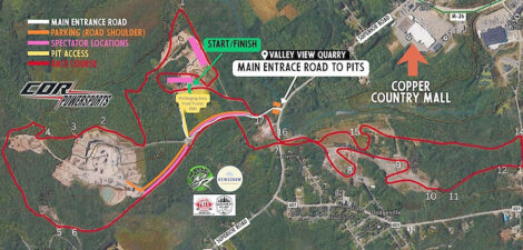
Lingering snow around Houghton leads to late snowmobile race

Former state rep Sara Cambensy announces run for state senate

Swajanen announces campaign launch event for Marquette County District Court bench
Lunchtime Live special edition hints at spring