Is a white Christmas ahead for U.P.?
ESCANABA — Today marks the first day of winter and the final days leading to Christmas. Although there is a chance of snow for today, weather forecasters says the chances for a white Christmas in the local area are not good.
“If there is not snow on the ground at your location at this time, the probabilities of snow on the ground for Christmas are well below their historical averages,” said Matt Zika, meteorologist at the National Weather Service in Negaunee. Snow levels in the U.P. at present are between zero to two to three inches on the ground up near Lake Superior.
Zika noted the fact the U.P. had so little snow this far into December is unusual. “Historically, the probabilities of a white Christmas across the U.P. range from around 65% across the south central U.P. (Menominee County) to nearly 100% across the Keweenaw Peninsula and favored northwest wind lake effect snow areas off of Lake Superior. Escanaba, historically, has about an 85% chance of a white Christmas,” he said.
While the snow belt areas near Lake Superior are expected to have some lake effect snow in time for Christmas, Zika said that it’s quite possible some areas of the U.P. won’t have any. For those hoping to have a white Christmas, the meteorologist says there is one chance — about 40% — around December 23 for a little snow across the U.P. “Regardless, it wouldn’t be a big event, but would be just enough to whiten the ground if we did get it,” he added.
Looking at the winter as a whole, Zika said that the U.P. has had a more mild winter so far due to a La Nina weather pattern causing lot of Pacific air to move across the north. The resulting warmer air hasn’t been generating the usual lake effect snow across the Great Lakes. Conversely, there have been stronger storms to the south.
The weather service says while the U.P. may get some brief cold snaps, dryer, warmer weather will probably be the norm over the next few weeks.
As to a longer-range forecast, “Looking at past winters with significant snowfall deficits (compared to normal) to start the winter, most of those years ended up having a seasonal snow year well below normal,” Zika says. While he cautions that it’s hard to say for certain at this point, it’s becoming more probable that there will be lower than usual snow this winter. “While that can change quickly with just a couple of mid- to late-winter snow storms across the south central U.P., there is not much pointing to an excessively snowy pattern developing at this time.”
Local News
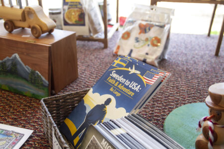
Escanaba man authors book on Swedish heritage and Christian journey
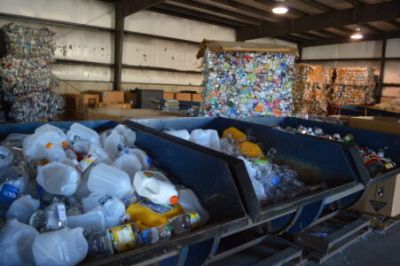
Delta County voters to decide on recycling millage renewal in August
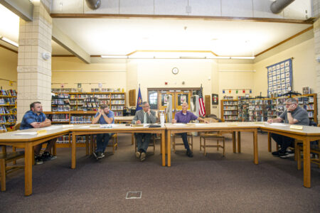
Gladstone school board budgets “conservatively”
Invest UP, EGLE present brownfield authority guide to county commissioners

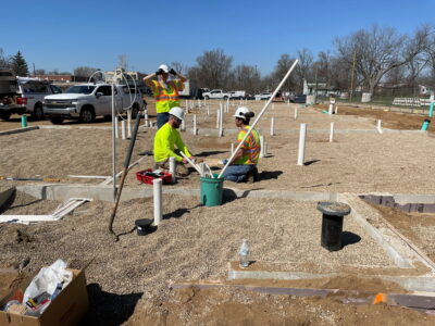
Pocket Park kicks off summer hours
Escanaba City Council to hold public hearing on Appropriations Ordinance
Editor’s note: Meeting agendas and their contents are subject to change. The following items were listed on the ...